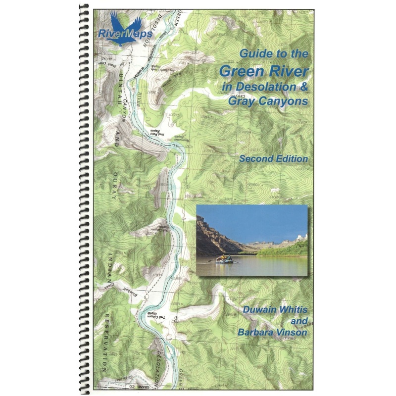
The RiverMaps Guide to the Green River in Desolation & Gray Canyons Utah.The 2nd Edition extends the original 84 mile trip from the Sand Wash put-in to the Swaseys Ramp takeout to 96 miles now that Tusher Dam allows boats to passand take out at the Green R
![]()
The RiverMaps Guide to the Green River in Desolation & Gray Canyons Utah.The 2nd Edition extends the original 84 mile trip from the Sand Wash put-in to the Swaseys Ramp takeout to 96 miles now that Tusher Dam allows boats to passand take out at the Green River State Park Boat Ramp.
Bonus: If the map gets wet, don’t worry! It can stay wet without damage. The pages usually won’t stick but you may need to air dry each page or wipe with a dry rag. You can write on dry plastic pages with an indelible marker. Entire guidebook is waterproof and tear resistant but not indestructible.
Reviews
There are no reviews yet.