The RiverMaps Guide to the Rio Chama is the go-to, mile-by-mile guide for floating the Rio Chama. Flowing through Wild and Sceniccanyons in northwestern New Mexico, the Rio Chama is forgiving enough for the less experienced but challenging enough to keep t
![]()
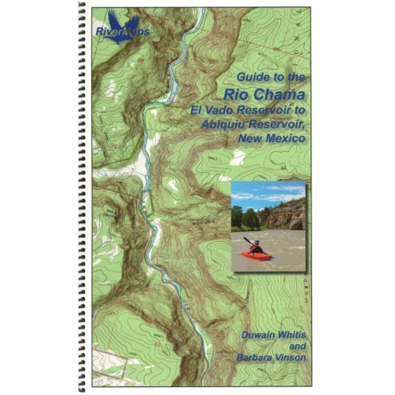
The RiverMaps Guide to the Rio Chama is the go-to, mile-by-mile guide for floating the Rio Chama. Flowing through Wild and Sceniccanyons in northwestern New Mexico, the Rio Chama is forgiving enough for the less experienced but challenging enough to keep the experienced boater’s attention. This guidebook covers 31 river miles from the put-in at Cooper’s El Vado Ranch to the Big Eddy takeout.
Bonus: If the map gets wet, don’t worry! It can stay wet without damage. The pages usually won’t stick but you may need to air dry each page or wipe with a dry rag. You can write on dry plastic pages with an indelible marker. Entire guidebook is waterproof and tear resistant but not indestructible.

Reviews
There are no reviews yet.